There is an interesting thing in the Museum of the Geological Survey on Vasilievsky Island – a map of the USSR made of gems “The Industry of Socialism”.
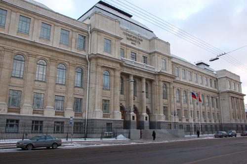
The Central Research Geological Survey Museum, which bears the name of the Academic F.N. Chernishov (CRGSM) is situated on Vasilievsky Island.
Its address is Sredny Prospect of Vasilievsky Island, 74. The time when it is open was published at the website incorrectly; it was my pure luck that I managed to get inside. So I advise you to phone them and not to trust Russian websites in such cases.
The museum is situated in the building of the ARRGI (A.P. Karpinsky All-Russian Research Geological Institute).
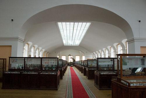
Apart from the map there are many things worth seeing in the museum.
In seven halls around 80 thousand specimens of minerals, fossilized flora and fauna are exhibited.
However, let us go back to the main subject of the album.
Near the map:
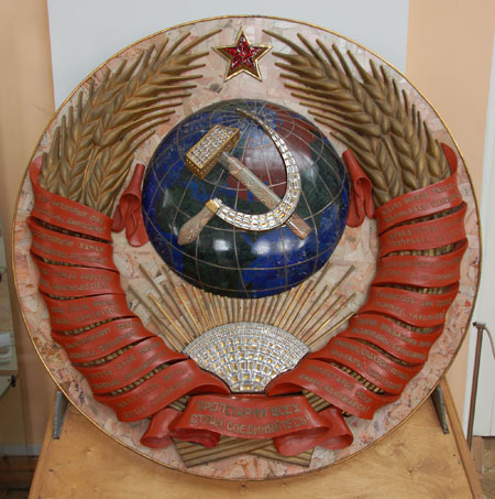
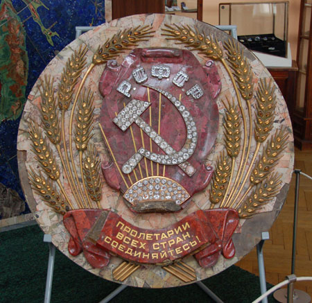
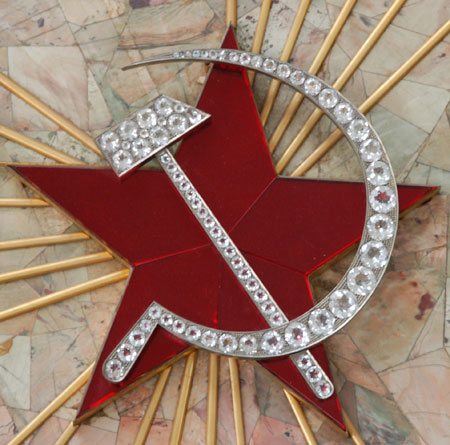
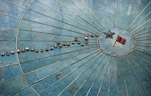
“The National Emblem of the USSR made of gems, a specimen of Russian stone carving art, 1937” is exhibited. “ Technique of work: Florentine and Russian mosaic, stone carving, faceting, jeweler’s works, gilding, moulding. Materials: semi-precious and precious stones, silver, alluminium, brass, textolite. Diameter – 130 sm. Weight – 200 kg.’
“The emblem of the USSR and 11 emblems of Union Republics (Russia, Byelorussia, the Ukraine, Georgia, Azerbaijan, Armenia, Tajikistan, Uzbekistan, Kirghizia, Turkmenistan, Kazakhstan). They were created for the projected in 1940-ies Palace of Soviets in Moscow. The project was not realized. In 1946 The Map of the USSR made of gems and the emblems were passed to the State Hermitage. Since 1988 they are in the CRGSM museum.
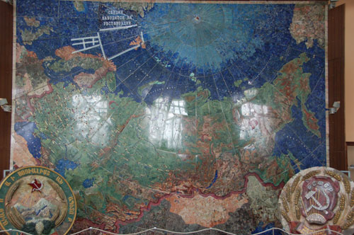
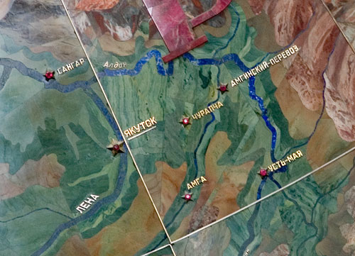
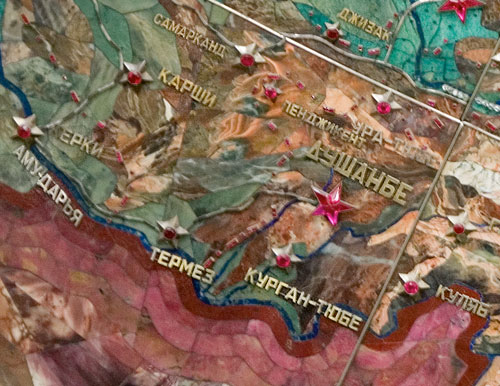
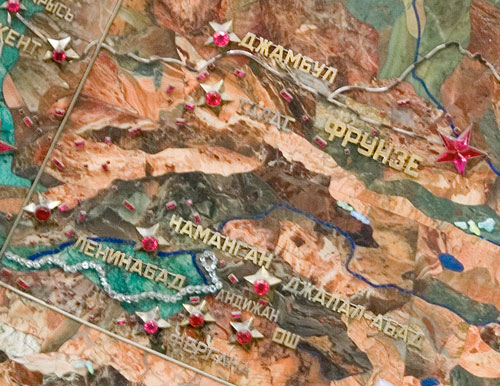
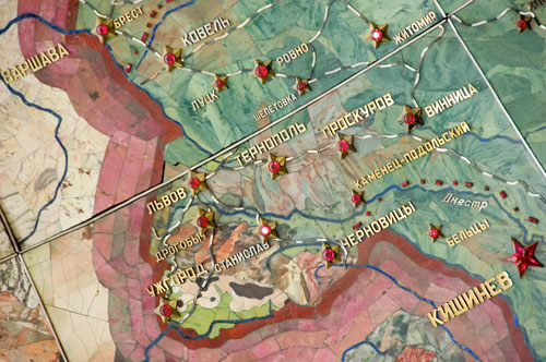
And here is the very map.
It was made in1936, then underwent some changes.
Up to 1988 it was in the Hermitage.
Size - approximately 6x4,5 meters.
Weight – 3,5 tons.
45 thousand plates of gems were fixed on textolite base, which in its turn was fixed on dural frame.
The idea of creating the map belongs to H.K. Orjonikidze (people’s commissar of heavy industry of the USSR).
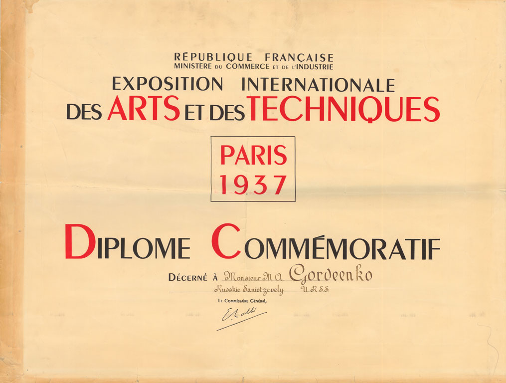
At the world exhibition in Paris in 1937 it was awarded the first prize (as well as the sculpture “Workman and Kolhosnitsa” by V. Mookhina)…
One of the readers of the Wandering Camera sent me a scanned image of the diploma his grandfather had received for working on this map.
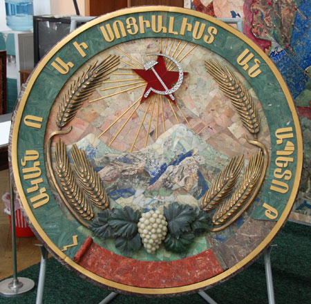
The emblem of RSFSR ( Russian Soviet Federative Socialist Republic)
The emblem of Armenian SSR
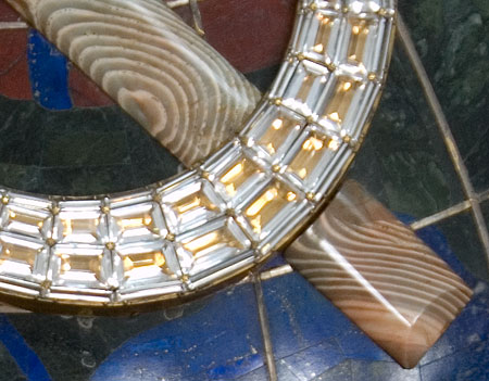
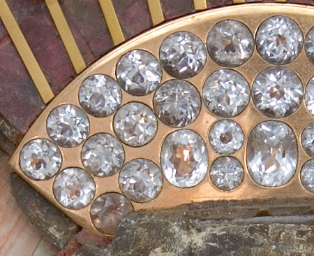
The large transparent stones are not natural diamonds, of course. It is either rock crystal or something artificial.
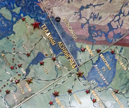
Kexholm is the contemporary Priozersk (renamed in 1948)
Pay attention to the spelling of the word “Tallinn” (the capital of Estonian SSR). In late soviet time the correct spelling was “Tallin”. During the perestroika they began to write “Tallinn” again, as if it had been the wish of the independent Estonia (I would say, it was the same principle as now when on TV in news programs they stubbornly say “in the Ukraine” instead of “on the Ukraine” ( as it has always been before) *.
Now everywhere “Tallin” is written again
(* Translator note – this sentence is referring to the prepositions “na” and “v” – “na Ukrainye” is considered offensive by some Ukrainians. Na is usually used in relation to some states which are also islands e.g. na Kube – “in Cuba”)
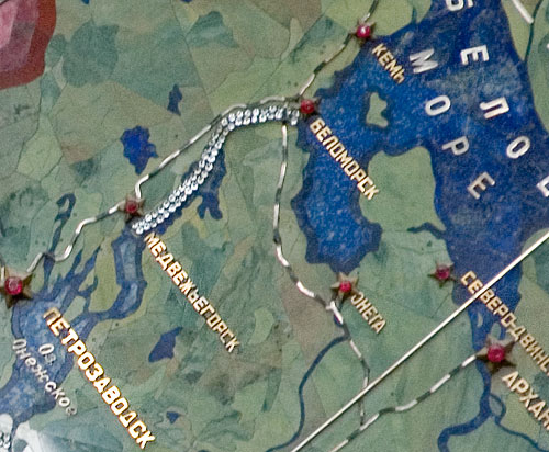
The chain of the small stones is the Belomoro-Baltijsky Canal
See also the map on the pack of cigarettes “Belomor”
It is a really amazing work to show the relief of mountains, the winding of the rivers with the stone plates and to stick to correct colours…
Leninabad since 1991 bears its old name Khoodjand (as it was till 1936).
Frunze is now (since 1991) Bishkek. As it was till1936.
Some time after the map had been made they tried to keep it up to date (changed the frontiers after the war with Finland and joining of the Baltic countries) but then they gave up doing this.
During the preparation for the New York exhibition in1939 the height of the upper side was raised to show the North Pole and the route of Papanin’s expedition. Their way was made of topazes and phenacites.
The map was awarded the exhibition gold medal.
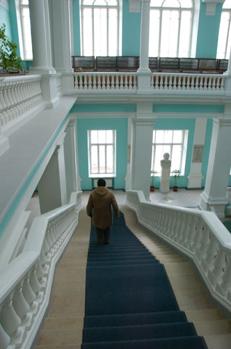
Funny, that taking pictures in the Institute is forbidden. Even on the stairs ;)
In conclusion I would like to quote the tablet near the map (it was obviously made in the same time period as the map):
“The map was created by the Committee of the All-Union Art Exhibition “The Industry of Socialism”
The organizer and monitor of the map making was F.S. Amstislavsky. The mosaic and jeweller’s work was carried out by the following enterprises of the trust “Russian Gems” of the People’s Comissariat for the RSFSR Local Industry: Leningrad Gems Processing Works Director of the works is H. I. Ukrainets.
The technique monitor of the mosaic and jeweller’s and faceting work is M.A. Gordienko.
Head of the mosaic department is N.D. Kuprenov. Mosaicers: V.P. Latynov, K.A. Andreev, P.M. Kremlev, E.I. Artemjev, A.A. Samokha, N.I. Kuprikov, V.V. Semenov, A.F. Pippar, V.A. Kusmin, V.V. Kiseleva, N.P. Ovchinnikov, E.A. Mironova.
Head of the jeweller’s department is V.A. Libenson. Jewellers: K.A. Svetilov, K.A. Stremberg, I.K. Zevakov, M.I. Borisov, I.F. Suvorov. Peterhof Precise Technical Stones Plant. Mosaicers: P.P. Kraubner, K. F. Chudinov, I. F. Fedorov, V.A. Kokovin, S.V. Morin. Sverdlovsk Faceting Factory. Mosaicers: A.S. Schubin, G.D. Tataurov, A.I. Podkorytov. Faceters: A.S. Kitaev, V.I. Voronov, V.I. Ojghibetsov, D.D. Sverev
Map editors and authors group: L.V. Gohenberg, A.N. Drobon, G.N. Davidov, A.V. Zalevskaia, A.J. Barsov
Geographical model was made by Moscow Cartographical Factory. Mosaic artists: prof. A.V. Frolov, P.A. Skvortsov, A.Z. Danilochina.
The frame constructor is an engineer I.L. Golovin.
Technical and installation work was done by engineer G.S. Levin
Metal frame was made by Moscow Experimental Constructions Works.
Textolite frame was made by Orekhovo-Zuevo
Works “Karbolite”
The map making work was begun on the 3 of Mai 1936 and finished in 1937.
667 people participated in it The map was shown at world exhibition in Paris in 1937 and in New York in 1939 The map was reconstructed in 1941.”

